Hydrography
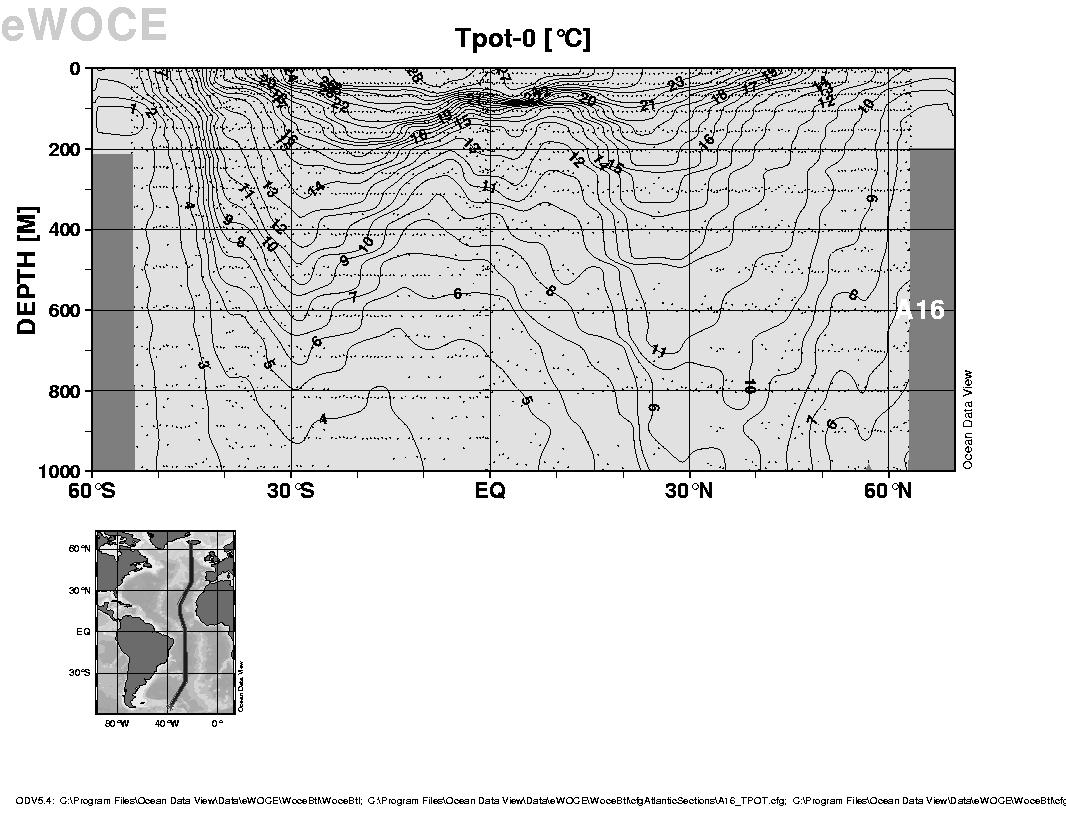
The Levitus climatology is a gridded data set based on many (~100) hydrographic sections across the ocean taken over the years from ship-board measurements of temperature and salinity as a function of depth. A hydrographic section showing temperature along 30W in the Atlantic is shown below: the position of the station data is marked by the vertical array of dots.
You can see other hydrographic sections by clicking on the list on the left.